Drones for Environmental Monitoring: How They Help Government Agencies
Government environmental officers and project managers need survey data that holds up. When a planning decision is challenged, a funding acquittal is due, or a species management program needs to justify its outcomes, the quality of the underlying evidence determines whether the agency is exposed or protected.
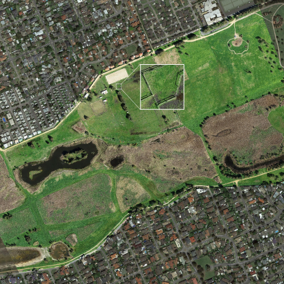
Drone-based environmental monitoring gives government agencies site-wide species data that traditional methods cannot produce in the same timeframe, across the same area, or with the same level of verifiable evidence. Thermal drone surveys cover up to 100 hectares per night for arboreal mammal surveys and thousands of hectares per week for open-terrain feral animal detection. Every detection is timestamped, georeferenced, and recorded with photo and video evidence, producing outputs that can be referenced directly in planning submissions, environmental impact assessments, compliance reports, and grant acquittals without additional interpretation work from agency staff.
For sites that are steep, remote, or hazardous to access at night, drone surveys also remove the need to put ground teams into difficult terrain after dark. That is a practical consideration for safety management on government-managed land, alongside the coverage and data quality benefits.
Below is how this works in practice, with outcomes from real government projects across Victoria and Gippsland.
The Data Problem Government Agencies Face
Traditional survey methods were designed for a world where covering a site thoroughly was simply not possible. Spotlighting surveys walk narrow transects. Camera traps record single fixed locations. Together, they produce partial coverage by design, and the agencies relying on that data make decisions knowing the picture is incomplete.
When survey data is incomplete, planning decisions rest on assumptions. If those assumptions prove wrong after infrastructure works proceed, the consequences include damage to protected species habitat post-construction, planning approvals challenged on the basis of inadequate due diligence, and funding programs that cannot demonstrate the outcomes they were meant to deliver.
For project officers and environmental managers who need to defend decisions to superiors, funding bodies, and planning panels, the quality of survey evidence is not a technical detail. It is a professional liability issue.
What Drone Environmental Monitoring Produces
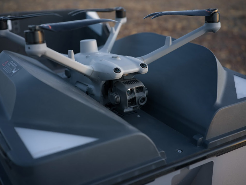
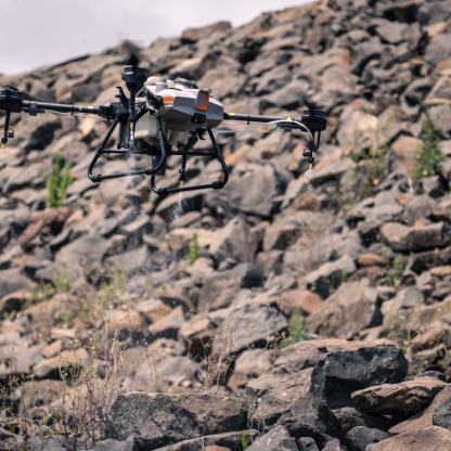
Field Master Systems conducts drone animal surveys using unmanned aerial systems fitted with thermal imaging cameras, high-resolution visual cameras, and LED spotlights. Surveys are conducted at night, when nocturnal species are active, across terrain that ground teams cannot safely or efficiently cover on foot.
When a thermal detection is made, the visual camera and spotlight confirm the species. Every detection is timestamped, georeferenced, and recorded with photo and video evidence. The output from every survey includes mapped detection points with exact GPS coordinates, species identification and count data, geospatial files compatible with GIS platforms, and summary documentation structured for planning and compliance use.
This is not data that requires interpretation to be useful. It is structured evidence that can be referenced directly in planning reports, funding acquittals, compliance submissions, and species management programs. When a decision is challenged, the data is there to support it.
Government Projects Where This Has Made a Difference
Pre-Construction Fauna Assessment, Cardinia Shire Council
Cardinia Shire Council needed accurate species data for a proposed road upgrade corridor before works could proceed. Multiple nocturnal species were expected to be present in roadside vegetation along the corridor. Ground-based spotlighting could not cover the full length of the corridor efficiently or safely at night, and incomplete coverage would have left the project exposed.
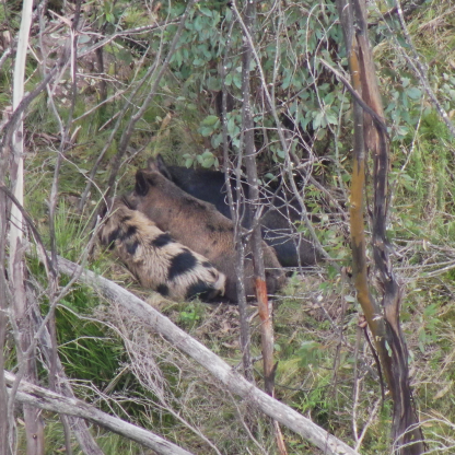
Field Master Systems deployed thermal drones along the corridor, surveying several kilometres of roadside vegetation in a single night. Hundreds of native animals were documented with photo, video, and GPS coordinates, including endangered Greater Gliders. Each detection carried a GPS location and photographic record.
Cardinia's project ecologists used this data to guide road design directly, identifying habitat trees for protection and developing species management programs that could be referenced throughout the project lifecycle.
"Using FMS technology and methodology, ecologists have accurately identified endangered species and have made a major contribution to the design of these roads and the establishment of species management programs." Peter, Cardinia Shire.
Read the full Cardinia Shire threatened species survey case study.
Fuel Reduction Burn Planning, Victorian Government
Fuel reduction burns are a critical fire management tool, but they take place in native forests where endangered species live. Southern Greater Gliders, Yellow-Belly Gliders, and other arboreal mammals occupy exactly the areas targeted for burns. Government agencies need accurate population data before proceeding, both to manage species risk and to demonstrate due diligence.
Traditional spotlighting cannot cover an entire burn unit, and putting survey teams into steep, remote terrain at night carries genuine operational risk alongside the coverage limitations.
Field Master Systems conducted drone surveys across proposed burn units using thermal cameras, zoom visual cameras, and LED spotlights. In one survey, more than 100 Southern Greater Gliders were positively identified within a 94 hectare area in a single night. Population counts, exact locations, and photographic evidence for each sighting were delivered to the responsible government agency to inform burn decisions and support ongoing species management obligations.
Feral Animal Monitoring, Gippsland, DEECA
The Department of Energy, Environment and Climate Action needed accurate feral pig population data across bushfire-affected areas of Gippsland to guide baiting programs and measure the effectiveness of existing control efforts. Trail cameras, the traditional method, produced population estimates across limited areas. Not the precise locations, movement patterns, or counts needed to run a targeted, defensible program.
Field Master Systems worked with DEECA to develop a drone survey methodology for feral pig detection. Thermal camera-equipped drones mapped pig locations precisely across thousands of hectares per week, generating structured reports that guided baiting decisions and provided measurable program outcomes that could be reported against.
Read the full Gippsland feral pig detection case study.
How Survey Outputs Are Structured for Government Use
Every Field Master Systems drone survey is planned around the reporting requirements of the project, not just the detection methodology. Outputs are built to slot into existing agency processes rather than requiring additional interpretation work from your team.
Geospatial detection files are compatible with standard GIS platforms (like ArcGIS) used across government and council environments. Summary documentation is structured for direct use in planning submissions, compliance reports, environmental impact assessments, and funding acquittals. Qualified ecologists are involved in interpreting data for threatened or rare species, providing the professional sign-off that planning processes require.
For agencies that need to demonstrate the effectiveness of grant-funded programs or justify continued investment in survey programs, the structured output from drone surveys provides a clear evidence base. Exact areas covered, species detected, and detection methods are all documented and repeatable across successive survey seasons.
Practical Considerations for Government Survey Programs
Thermal drone surveys perform best in cooler conditions when the contrast between animal heat signatures and ambient temperature is highest. In south-eastern Australia, late autumn through spring is the optimal window for most species, which aligns well with planning and budget cycles for many agencies. Field Master Systems matches survey scheduling to target species activity patterns to maximise detection rates within the available survey window.
For sites that are steep, remote, or hazardous to access at night, drone surveys remove the operational risk of putting ground teams into difficult terrain after dark. This is a consideration for both safety management and insurance obligations on government-managed land.
For pre-construction programs with fixed project timelines, drone surveys can cover large areas quickly, reducing the risk of fauna assessment programs becoming a bottleneck in project schedules.
A Note on the Two Sides of Animal Surveying
Government agencies engage Field Master Systems for two distinct types of work, and the audiences and objectives are meaningfully different.
Infrastructure and development agencies need pre-construction fauna assessments to identify threatened and endangered species before works begin. The driver is statutory compliance: a Greater Glider or Koala found in the survey area directly affects approvals, design decisions, and species management obligations throughout the project. The data needs to be comprehensive, defensible, and available before works proceed.
Environmental management agencies, including those managing national parks, conservation reserves, and public land, need accurate feral animal population data to design and evaluate pest control programs. The driver is ecological outcomes: knowing exactly where feral pigs, deer, or other pest species are concentrated, and being able to demonstrate reductions over time. The data needs to be consistent across survey seasons and structured for program reporting.
Field Master Systems works across both. The survey methodology is adapted for each, and the outputs are structured to meet the specific reporting requirements of each agency type.
Frequently Asked Questions
What species can be detected using drone thermal surveys?
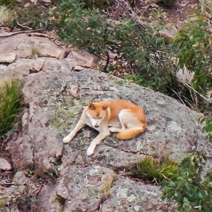
Field Master Systems drone surveys can detect a wide range of native and introduced species including Greater Gliders, Yellow-Belly Gliders, Feathertail Gliders, Sugar Gliders, Leadbeater's Possums, Koalas, feral cats, feral dogs, pigs, deer, foxes, and rabbits. Species are confirmed using thermal detection combined with a zoom visual camera and LED spotlight where required.
Are drone survey outputs accepted for environmental compliance and planning submissions?
Survey outputs include timestamped, georeferenced photos and videos, mapped detection locations, species counts, and summary reports structured for planning, compliance, and reporting use. Qualified ecologists interpret data for threatened or rare species. Cardinia Shire Council used Field Master Systems drone survey data directly to guide road design and develop species management programs referenced throughout the project.
How does drone survey data support funding acquittals and program reporting?
Drone survey outputs document exact areas covered, species detected, detection methodology, and results in a structured format that can be referenced directly in grant acquittals and program reports. For agencies that need to demonstrate the effectiveness of funded programs, the precision and repeatability of drone survey data provides a clear evidence base across successive survey seasons.
When is the best time of year for drone thermal surveys?
Thermal surveys work best in cooler months when temperature contrast is higher. In south-eastern Australia, late autumn to spring is the optimal window. Survey timing is matched to target species activity patterns to maximise detection rates within the available survey period.
Can drone surveys work alongside existing ground-based ecological methods?
Yes. Drone surveys complement established ecological methods. They add site-wide spatial coverage that supports the work of ecologists and environmental officers, particularly across large or complex sites where full manual coverage is not achievable in a single field program. Survey outputs are structured to integrate with existing agency GIS platforms and reporting frameworks.
Where does Field Master Systems operate?
Field Master Systems conducts drone animal surveys and environmental monitoring across Victoria, New South Wales, and Queensland, working with government agencies, councils, land managers, and ecological consultants. Get in touch to discuss your survey requirements.