How Drones Can Aid in Aerial Photogrammetry
How Drones Can Aid in Aerial Photogrammetry
Traditional surveying methods often leave project managers trapped between a rock and a hard place. Manually trekking across vast or hazardous terrain is time-consuming, expensive and puts your team at unnecessary risk. Even then, the data collected can be sparse, leading to costly errors in volume calculations or site planning that only surface when it is too late to fix them easily.
Aerial photogrammetry removes these bottlenecks by capturing thousands of precise data points in one flight. By automating data collection, you gain a high-resolution digital record without the manual labour. Read on to learn how drone technology integrates with modern surveying and the specific equipment needed to achieve centimetre-level accuracy.
What is Aerial Photogrammetry?
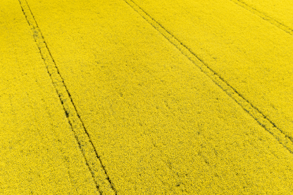
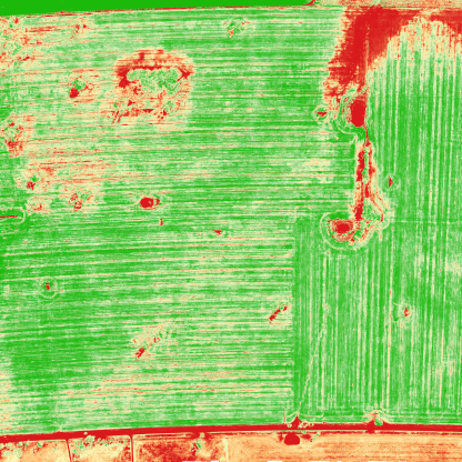
Aerial photogrammetry is the process of using overlapping photographs to determine the exact measurements and positions of physical objects on the ground. By capturing a series of high-resolution images from a drone, specialised software triangulates specific points to build detailed 2D maps and 3D models. This method provides a comprehensive visual record that far exceeds the detail of traditional point-collected data. When paired with drone mapping software, these images are stitched together into centimetre-accurate orthomosaics.
How Drones Can Aid in Aerial Photogrammetry
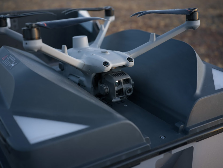
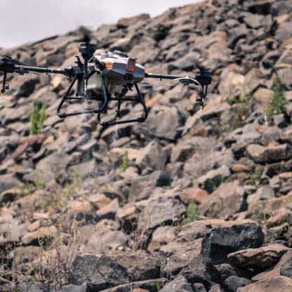
Drones have transformed the way spatial data is captured by providing a flexible and high-precision platform for cameras. Unlike traditional aircraft that are restricted by high altitudes and significant costs, drones can fly closer to the ground. This proximity allows for the capture of extremely high-resolution imagery, which is the foundation of accurate aerial photogrammetry.
By automating the data collection process, drones aid the industry in several key ways:
- High-Density Data Capture: Drones can capture thousands of images in a single session, providing a much higher density of data points than ground-based GPS surveying.
- Access to Hard-to-Reach Areas: They easily navigate steep terrain, stockpiles or restricted zones that would be dangerous or impossible for personnel to access on foot.
- Consistent Overlap: Integrated flight planning software ensures that every photo has the precise amount of overlap required for the photogrammetric software to stitch images without gaps.
- Rapid Turnaround: Data can be collected and uploaded for processing on the same day, allowing project managers to make decisions based on near real-time site conditions.
This level of efficiency ensures that projects stay on schedule and within budget. Instead of waiting days for a survey crew to complete a site walk, a drone operator can achieve the same results in a fraction of the time, delivering a complete digital twin that is ready for analysis.
Why Use Drones for Aerial Photogrammetry in Australia?
Implementing drones for aerial photogrammetry offers a significant return on investment compared to ground-based methods or manned aircraft. In Australia, where sites are often remote or expansive, drones provide a fast and cost-effective way to monitor progress.
- Speed: Survey sites in a fraction of the time taken by ground crews.
- Safety: Use drone surveillance techniques to capture data from unstable slopes or busy construction zones without entering the area.
- Accuracy: Achieve high-resolution results that are essential for detailed topographic maps and site analysis.
- Cost: Significantly lower investment compared to ground-based methods or manned aircraft. In Australia, where sites are often remote or expansive, drones provide a fast and cost-effective way to monitor progress.
How Does Drone Photogrammetry Work?
The process starts with a programmed flight path where the drone captures images with a high degree of overlap. This ensures every feature is seen from multiple angles. For professional results, RTK enabled drones are often used to provide real-time positioning data. Once the flight is finished, the photos are processed to generate regular 2D maps that reflect the current site conditions with high precision.
Which Industries Benefit From Aerial Photogrammetry?
The versatility of this technology has made it a staple for various Australian sectors. Beyond basic mapping, aerial photogrammetry provides high-precision data that supports long-term planning and asset management across several fields:
Selecting the right professional surveying equipment from Field Master Systems ensures your data meets the rigorous standards required for these specialised applications.
Get the Precision Your Project Deserves
Stop settling for guesswork or outdated survey methods that slow you down. Field Master Systems provides the advanced hardware and technical support needed to capture centimetre-accurate data with ease. Whether you are managing a mine site or a new build, our tools help you make informed decisions faster while keeping your crew safe on the ground. Take control of your site data today and see the difference that professional drone technology makes to your bottom line. Contact our team for questions today.
FAQs
How accurate is drone photogrammetry compared to traditional surveying?
With professional-grade equipment and proper methodology, drone photogrammetry can achieve horizontal accuracy of 1–3 cm and vertical accuracy of 3–5 cm. While traditional surveying still holds the lead for millimetre-level precision required for legal boundaries, drones are often superior for topographic mapping and volume calculations due to the sheer density of data points they capture.
What is Ground Sample Distance (GSD)?
GSD refers to the distance between the centres of two consecutive pixels measured on the ground. A GSD of 2 cm/pixel means that one pixel in your digital map represents a 2 x 2cm piece of ground, or 4cm2
of actual ground. Lower flight altitudes result in a smaller GSD, which provides higher resolution and better detail in your final models.
What is the difference between photogrammetry and LiDAR?
Photogrammetry uses high-resolution photos to create models based on visual features, making it excellent for capturing textures and colours. LiDAR (Light Detection and Ranging) uses laser pulses to measure distances. LiDAR is also highly accurate compared to photogrammetry. Its primary advantage is the ability to “see” through dense vegetation and accurately map the ground surface, whereas photogrammetry requires a clear line of sight to the terrain.
Do I need Ground Control Points (GCPs) if I use an RTK drone?
RTK drones can give very precise location data in real time, which means you usually need fewer GCPs. That said, it’s still best practice to use a few GCPs or “checkpoints” to make sure your model is perfectly aligned with the site. Most survey professionals actually prefer PPK drones over RTK because PPK can be even more accurate, especially in tricky conditions.
What is an orthomosaic map?
An orthomosaic is a high-resolution map created by stitching together hundreds of individual aerial images. Unlike a standard aerial photo, an orthomosaic has been geometrically corrected for lens distortion, camera tilt and topographic relief. This means the map is uniform in scale and can be used to measure true distances just like a traditional CAD drawing.
What are the legal requirements for flying drones for surveying in Australia?
In Australia, any drone used for commercial purposes must be operated under a Remote Pilot Licence (RePL) or within the "excluded category" rules set by CASA (Civil Aviation Safety Authority). Operators must register their drones and follow strict flight safety regulations, including maintaining a visual line of sight and staying below 120 metres in controlled airspace.