Drone Inspections for Water Utilities: Meeting Compliance Without Sending Crews On-Site
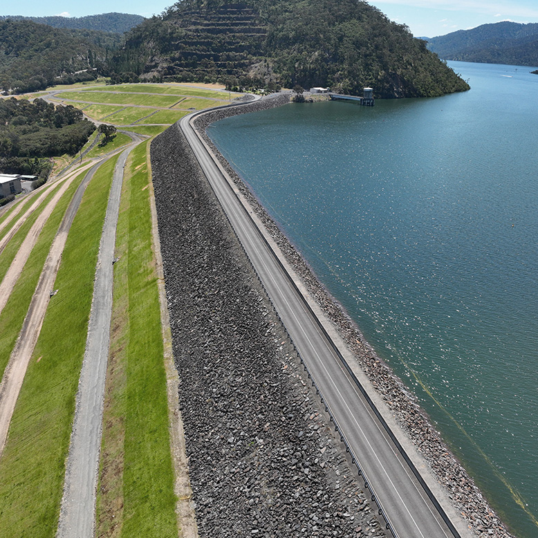
Water utilities manage assets that are difficult and often dangerous to reach. Dam walls, open channels, reservoir banks and treatment ponds sit across steep terrain, deep water and long corridors. Field Master Systems inspects and maps this infrastructure from the air with drones, capturing the condition and vegetation data utilities need while keeping crews off the hazard.
Aerial inspection suits water infrastructure because a drone records a dam wall or a canal reach in a single flight and delivers the result in standard mapping formats that engineering and maintenance teams can use. The work is flown from stable ground, which takes people off steep walls and away from open water.
What a drone inspection captures on water infrastructure
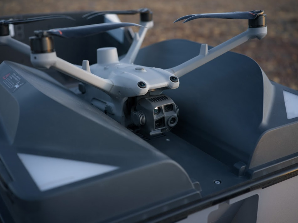
Field Master Systems captures visual (RGB), thermal, multispectral and LiDAR data to record water assets in detail. Its drone mapping services produce high-resolution imagery, 3D models and elevation data accurate to five centimetres using RTK satellite positioning. On a dam, that produces a complete surface model of the wall. On a canal network, it produces obstacle-aware maps that capture the structure and everything around it. Maps are supplied as GeoTIFFs, point clouds or standard image files.
Water infrastructure projects in Victoria
Field Master Systems has mapped and treated water infrastructure for Goulburn Murray Water and Melbourne Water. Both projects followed the same pattern: map the asset in detail, then act on what the map shows.
Dam walls for Goulburn Murray Water
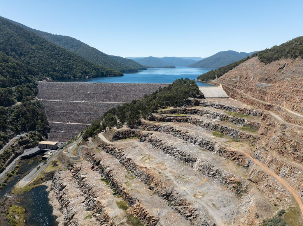
Goulburn Murray Water manages dam facilities with steep artificial walls that need regular vegetation control to prevent structural issues and maintain staff access. These walls sit close to public roads and had been treated by hand and by helicopter. For dam wall weed control along the Goulburn River, Field Master Systems mapped each wall to build a highly accurate 3D model using an RTK enabled DJI mapping drone, then used that model to plan flight paths for targeted drone weed spraying with a DJI Agras spray drone. The herbicide was applied at a consistent rate across the surface of the wall without overspray into the water. The mapping step is the inspection: it records the full face of the wall and locates the vegetation that needs treatment.
Channels for Melbourne Water
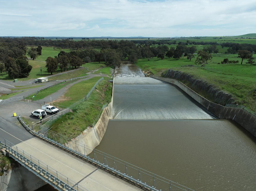
At Melbourne Water's Western Treatment Plant at Cocoroc, open channels need blanket weed treatment so vegetation does not compromise the integrity of the concrete or block access. The site is dense with structures, poles, power lines and fences. Field Master Systems created obstacle-aware maps for the canal weed control at the Western Treatment Plant, so the spray drones could avoid every obstacle while achieving total coverage. The team treated over twenty kilometres of water channel per day with minimal overspray into the abutting paddocks. The weeds also carried chemical resistance from past herbicide treatments, which added to the difficulty of the job.
Keeping crews off hazardous access
The clearest benefit for water utilities is taking people out of dangerous access work. Dam walls are steep and close to traffic, and channels are tight and full of obstacles. A drone pilot on stable ground records and treats these structures without putting crews on steep walls or in low-level helicopter passes. Each survey is repeatable, so the same wall or channel can be captured the same way on every cycle and compared over time.
Monitoring remote and high-value assets
Alongside scheduled mapping, Field Master Systems provides drone surveillance for real-time asset monitoring. High-performance zoom cameras read fine detail from several hundred metres away, and the team holds CASA certification for night operations, so assets can be checked after dark. Extended and beyond visual line of sight operations let a single flight follow long linear assets such as open channels. For utilities with infrastructure spread across regional Victoria, this is a fast way to check the condition and security of remote sites.
What a drone inspection delivers
- High-resolution visua, thermal, multispectral or LiDAR imagery of the asset surface
- 3D models and elevation data accurate to five centimetres
- Obstacle-aware maps that capture surrounding structures, poles and power lines
- The location of vegetation that threatens structural integrity or access
- Repeatable, georeferenced records that can be compared across inspection cycles
Supporting inspection and maintenance routines
Water utilities inspect, document and maintain their assets on a continuous cycle. Aerial inspection supports that work in three practical ways. It produces consistent, georeferenced data that can be compared from one cycle to the next. It keeps the work safe by taking crews off steep walls and away from open water. And it shortens the time between spotting a problem, such as vegetation breaking through a concrete channel, and acting on it. Field Master Systems builds each program around the assets involved and the reporting the utility needs.
Frequently Asked Questions
Can drones inspect dam walls and canals safely?
Yes. Field Master Systems maps and treats dam walls and canals from the air, with the pilot positioned on stable ground. This takes crews off steep walls near public roads and away from obstacle-dense channels.
What does a drone inspection of water infrastructure capture?
It captures high-resolution visual imagery, LiDAR and 3D elevation models, and obstacle-aware maps accurate to five centimetres using RTK positioning. Files are supplied as GeoTIFFs, georeferenced PDFs or standard images.
Can drones identify vegetation that threatens dam walls and channels?
Yes. Detailed mapping locates vegetation across a wall or channel, which matters because weeds can compromise the integrity of concrete structures and block staff access. The mapped locations then guide precise herbicide treatment.
Can you inspect long or remote assets such as channels?
Yes. Long linear assets suit aerial work. At Melbourne Water's Western Treatment Plant, Field Master Systems treated over twenty kilometres of canal per day, and drone surveillance with extended and beyond visual line of sight covers long corridors for monitoring.
Which water authorities has Field Master Systems worked with?
Field Master Systems has delivered drone mapping and treatment for Goulburn Murray Water on dam walls along the Goulburn River, the North Central Catchment Management Authority for Pale Yellow Water Lily mapping, and for Melbourne Water on the canals at the Western Treatment Plant in Cocoroc.
Plan a drone inspection of your water assets
Drone inspection and mapping deliver the most value as a repeatable routine, with each cycle compared against the last. Through RPAS consulting, Field Master Systems can also help water utilities build their own drone capability for ongoing inspection and monitoring. To scope a drone inspection or mapping program for your water assets, contact the Field Master Systems team.