

Optimise Site Efficiency with Advanced Construction Drone Services
We push the boundaries of what is possible by creating customised drone solutions that help your organisation grow. Our team of professional pilots and engineers provides the expertise to deploy drones in construction for accurate site surveys and progress tracking, ensuring your project remains on schedule from start to finish.
Request a QuoteOur Construction Drone Services Empower Various Sectors
We deploy advanced drones in construction to provide tailored solutions across building, development, and environmental sectors, including specialised civil engineering projects.
Government
Improve public works with advanced drone mapping and data. Our construction drone services help councils like Cardinia and DEECA track progress and maintain safety for public assets.See how the new DJI Dock 3 is allowing agricultural businesses to save time and money with autonomous operations.
Conservation
Monitor and protect delicate ecosystems during the development phase with detailed aerial mapping that ensures environmental compliance.See how the new DJI Dock 3 is allowing agricultural businesses to save time and money with autonomous operations.
Agriculture
Optimise rural building projects such as dams, sheds and irrigation systems with precise site surveys and topographic data.See how the new DJI Dock 3 is allowing agricultural businesses to save time and money with autonomous operations.
Forestry
Support sustainable timber operations and preserve forest health by using aerial insights to plan and monitor road construction and asset management within forested areas.See how the new DJI Dock 3 is allowing agricultural businesses to save time and money with autonomous operations.
Infrastructure and Water
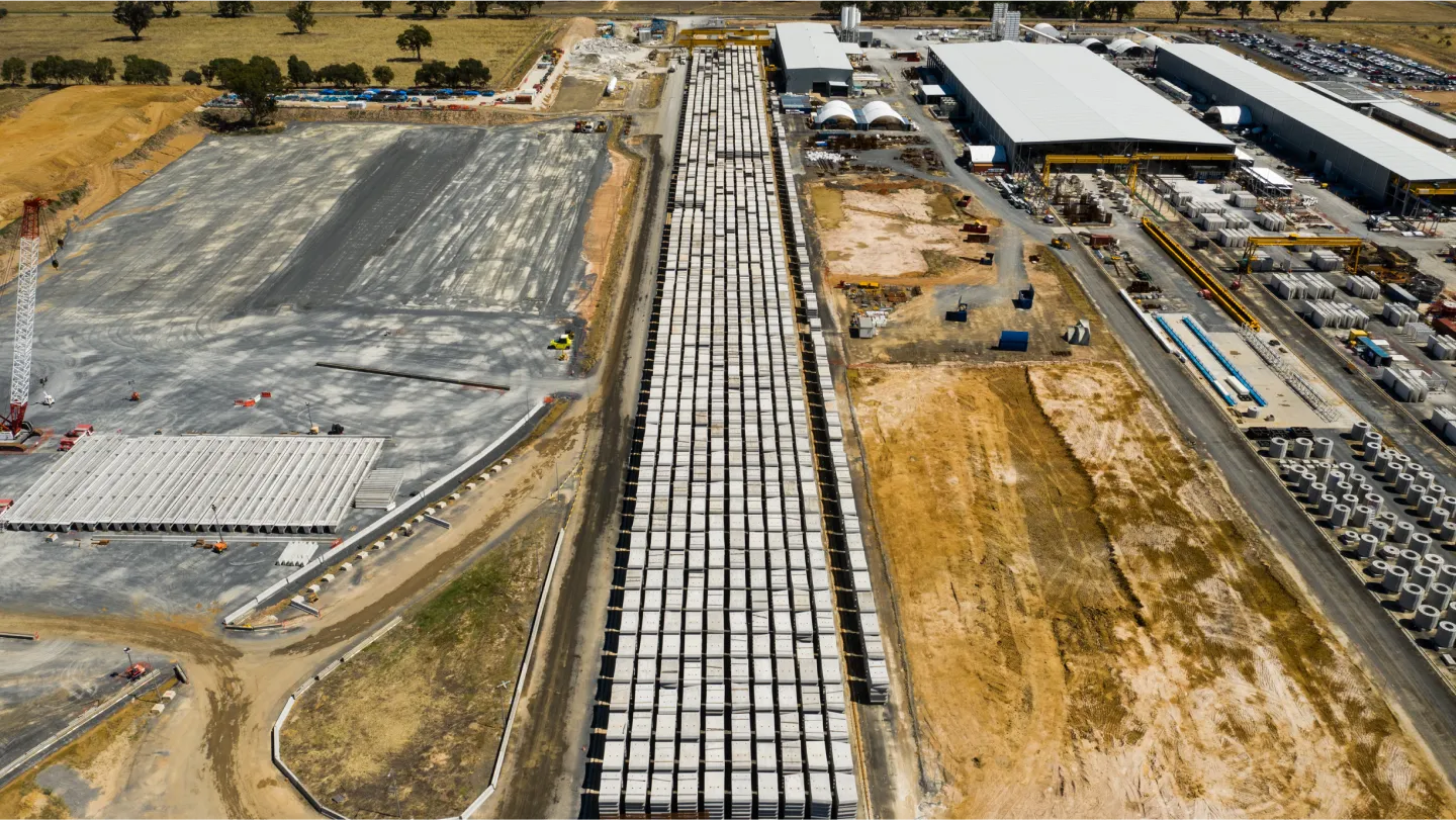
Ensure accuracy for roads and bridges with 3D modelling and aerial cartography. We partner with water authorities and civil engineering firms to provide safety inspections for large civil projects.Optimise rural building projects such as dams, sheds and irrigation systems with precise site surveys and topographic data.See how the new DJI Dock 3 is allowing agricultural businesses to save time and money with autonomous operations.
Residential and Commercial Development
Streamline project timelines for housing estates and large-scale structures with rapid site surveys and consistent progress monitoring.Support sustainable timber operations and preserve forest health by using aerial insights to plan and monitor road construction and asset management within forested areas.See how the new DJI Dock 3 is allowing agricultural businesses to save time and money with autonomous operations.
Data-Driven Construction Site Security
Are you looking for better ways to protect your building projects and sites with evidence-based data? Our professional drone solutions provide the precision and security oversight needed to keep your operations safe and on schedule. We help civil engineering teams monitor high-value assets and secure perimeters day or night.
Progress Tracking
Maintain a clear overview of your timeline and site perimeter to prevent delays and unauthorised access.
Site Inspections
Assess high-risk zones using aerial surveillance to detect site breaches or structural vulnerabilities without risking personnel.
Topographic Surveys
Capture accurate site data and boundary mapping to ensure project foundations remain secure and properly demarcated.
Asset Management
Monitor equipment and materials 24/7 to prevent theft and improve resource allocation through professional drone consulting.
Safety Monitoring
Improve onsite safety by using drones to perform rapid security audits and monitor compliance across active work zones.
Volumetric Analysis
Achieve accurate measurements for stockpiles and excavations to monitor material levels and prevent onsite shrinkage.


"Goulburn Murray Water have really valued working with the guys at Field Master Systems. This has helped us look at ways we can utilise drones to improve our efficiencies in our everyday spray operations. Regardless of differing weed types in varying terrains/situations they have been able to adapt the drone spraying to work efficiently and effectively."
Danielle, GM Water
Why Choose Us for Your Construction Drone Services
Led by Qualified Engineer
Our team is led by seasoned aviation experts, including a former A330 airline pilot and a licensed electronic and electrical engineer with over 30 years of experience.
Precision-Driven Data and Mapping
We utilise advanced sensors including LiDAR and high-resolution visual cameras to deliver superior data quality and 3D modelling.
Rigorous Safety and Compliance Protocols
We operate with comprehensive procedures and manuals that meet strict industry standards, ensuring every mission is efficient and compliant with CASA regulations.
Customised Drone Consulting and Strategy
We help your organisation build its own internal drone capabilities through specialised training, safety audits and expert operations manuals.
Advanced Real-Time Monitoring
Our technology provides live intelligence gathering and asset protection day or night, assisting in critical decision-making and emergency response.
Licences and Qualifications
Our team maintains extensive qualifications to ensure all drones in construction projects meet the highest professional and safety standards.
Beyond Visual Line of Sight (BVLOS)
Extended Visual Line of Sight (EVLOS)
CASA Night Operations Certification
Aeronautical Radio Operator Certificate (AROC)
Work with People Who Value Your Project Success
Ready to improve safety and precision with advanced construction drone services? Contact our aviation professionals for a customised quote. We provide the expertise to integrate drones in construction into your workflow, ensuring projects stay on schedule and meet all regulatory standards.
FAQ
Discover answers to common queries about our drone services and solutions. Explore how our expertise can benefit your projects and operations.
Drones are utilised across all phases of a build to monitor work, detect issues early and ensure site safety. We deploy drones in construction for specialized tasks including site surveys, progress tracking and real-time asset monitoring to help project managers maintain peak efficiency.
The primary advantages include improved safety by keeping workers out of hazardous areas and significantly reduced surveying expenses. By providing data-rich insights through drone mapping services, our clients achieve higher data accuracy and faster project timelines.
Yes, drones equipped with high-resolution sensors and LiDAR can produce highly accurate 2D maps and 3D models. Our construction drone services utilise advanced photogrammetry to measure real-life distances with minimal downtime, ensuring your project planning is based on precise topographic data.
In Australia, commercial drone operations must be conducted by pilots holding a Remote Pilot Licence (RePL) under a valid Remote Operators Certificate (ReOC). Field Master Systems operates with full CASA compliance, ensuring every mission meets strict aviation and safety standards.
Drones capture thousands of data points to generate dense point clouds and digital elevation models. This allows for automatic volume calculation with cut-and-fill data, helping earthmoving operations track material usage and costs with exceptional precision.
Our technology can safely inspect high-risk areas such as unstable structures, roofs or tall buildings without the need for scaffolding. Through professional drone consulting, we help companies implement aerial inspections that identify structural issues or leaks before they become costly.